FLOOD WARNING for North Bay-Mattawa watershed
Watershed Conditions Statement – Flood Outlook for Lake Nipissing Shoreline and Mattawa River downstream of Hurdman Dam
Watershed Conditions Statement – Flood Outlook has been issued for the Lake Nipissing Shoreline and Mattawa River downstream of Hurdman Dam and a Flood Warning remains in effect for the North Bay-Mattawa watershed, according to the North Bay-Mattawa Conservation Authority (NBMCA).

"Approximately 80 mm of rain fell across the watershed between April 12 and 14. Month-to-date, more than 174% of normal April precipitation has been recorded at the North Bay Airport,” said Angela Mills, NBMCA Flood Duty Officer. "Additional rainfall is anticipated for the coming week with 30-40 mm cumulative rain forecast mostly on Thursday (Apr 16) and Saturday."
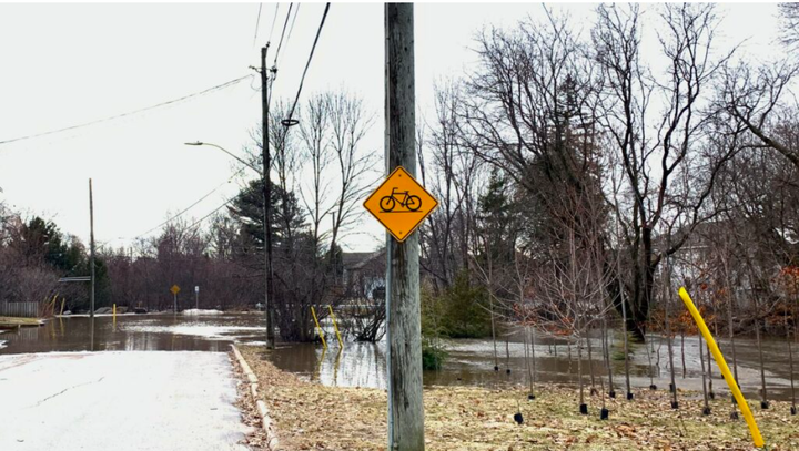
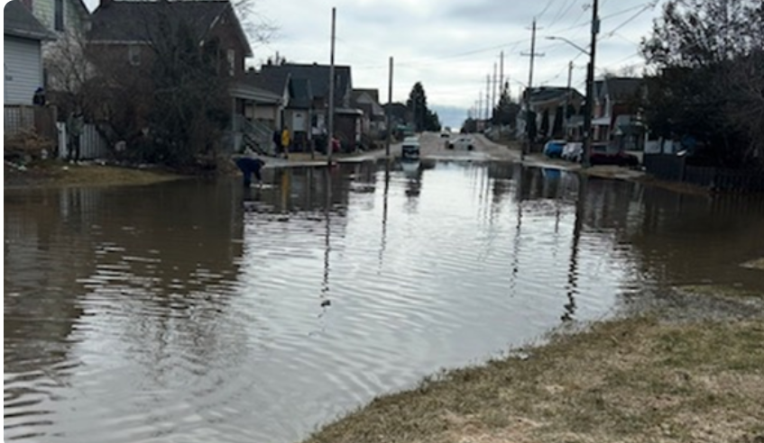
Flood water from Chippewa Creek impacted homes and streets in North Bay yesterday (Apr 14). Water level was the highest recorded at the Chippewa Creek gauge since data collection began in 2002. The volume of water moving through the system was highest since data collection began in 1974, with the next highest flow being from April 9, 1980. Water level on Chippewa Creek has receded by 106 cm and remains very high.
Water levels on the La Vase River have risen 106 cm since April 9 and are now beginning to recede. Flow reached levels comparable to the previous recorded maximum from Apr 1, 1998 (data since 1974). Corbeil Conservation Area is closed due to flooding.

Wasi River levels have risen 78 cm since April 12 and are now beginning to recede. Flow remains below the previous maximum from April 2016 (data since 2002).
Water levels in the Mattawa River system water levels are still rising, with some
areas beginning to stabilize as water drains through the watershed.
Turtle/Trout Lake is 13 cm above its previous maximum (2019 peak; data since 2018). Lake Nosbonsing is 3 cm below its previous maximum (2019 peak; data since 2018). Lake Talon is 13 cm above its previous maximum (2023 peak; data since 2018). Chant Plein Lake is 3 cm below its previous maximum (2019 peak; data since 2018). Mattawa River below Boullion Lake has risen more than 75 cm since Sunday, April 12. Mattawa Island Conservation Area is closed due to flooding.
The public is encouraged to keep children and pets away from watercourses and shorelines. Avoid driving through flooded areas if possible. For flood emergencies, contact your local municipality. Residents of unincorporated townships should contact the Ministry of Natural Resources – North Bay District.
NBMCA staff will continue to monitor conditions as part of the Authority's Flood Forecasting and Warning Program and will update this message as needed.
Current flood status and condition updates are available at nbmca.ca. This statement is also distributed to local media and posted on X (@theNBMCA), Facebook (@theNBMCA), and Instagram (@nbmcainfo).
This message is in effect until Monday April 20, 2026, at 4:00 PM EDT.
Note: The North Bay-Mattawa Conservation Authority is responsible for local flood forecast and warning programs for residents who live within the jurisdiction, including those in North Bay and Callander to Mattawa. Where a Conservation Authority has not been established, the local MNR District Office is responsible for local Flood Forecast and Warning programs, including along the Ottawa River, see MNR Flood Forecast and Warning.
CONTACT:
Angela Mills, Flood Duty Officer, cell: 705-497-4668
Paula Loranger, Community Relations Coordinator, cell: 705-494-5115
Terminology: Notification Levels
WATERSHED CONDITIONS STATEMENT: general notices of potential flooding or other conditions that pose a safety risk. There are two kinds of statements:

Water Safety indicates that high flows, unsafe banks, melting ice or other factors could be dangerous for users such as anglers, boaters, swimmers, children or pets. Flooding is not expected.

Flood Outlook gives early notice of the potential for flooding based on weather forecasts calling for heavy rain, snow melt, high wind or other conditions that could lead to high runoff, cause ice jams, lakeshore flooding or erosion.
FLOOD WATCH
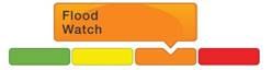
FLOOD WATCH notifies that the potential for flooding exists within specific watercourses and municipalities. Municipalities, emergency services and individual landowners in flood-prone areas should prepare.
FLOOD WARNING

FLOOD WARNING notifies that flooding is imminent or already occurring in specific watercourses or municipalities. Municipalities and individuals should take action to deal with flood conditions. This may include road closures and evacuations.